Main Content
Learn how to apply GIS technology to wetlands mapping, analysis, and data management in this 12-hour online evening course designed for environmental professionals.
Course Status Notice – Not Scheduled
We do not have an offering of this course scheduled at this time. Please join our email list to be notified when the next offering is scheduled!
Jump to: Overview | Instructor | Reviews | CE Credits | Contact Us | Related Courses | Join Email List
Course Details
Course Name: GIS for Wetland Professionals
Course Code: EG0923WA26
Date of Most Recent Offering: March 4, 11, 18, and 25, 2026
Course Overview
Learn how to apply GIS technology in wetlands management, research, and regulation. This 12-hour online course provides hands-on training in Geographic Information Systems (GIS) tailored specifically for wetlands professionals. Through guided instruction and practical exercises, participants will gain the skills to map, analyze, and communicate spatial data effectively in real-world wetlands scenarios.
Featured Topics
- Wetlands data sources and mapping
- Delineation and field data collection
- Identification and database management
- Bathymetry and flood analysis
ArcGIS Pro Software Access
All participants in this course will receive access to the ArcGIS Pro software during the class and for six months following the conclusion of the course.
Prerequisite
To get the most out of this class, students should come with an understanding of the basic concepts of Geographic Information Systems.
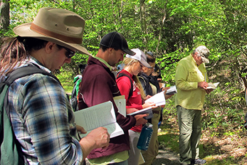
Who Should Attend?
This course is ideal for experienced and aspiring professionals who work with wetlands and want to enhance their technical skillset with GIS. It is especially beneficial for:
- Wetlands managers seeking to improve spatial planning and resource monitoring;
- Environmental scientists and ecologists involved in field data collection and analysis;
- Regulatory specialists who need to interpret and communicate spatial data for compliance and permitting;
- Researchers and consultants working on habitat assessments, restoration projects, or flood modeling;
- Graduate students or early-career professionals looking to build GIS competency for career advancement.
Meet Your Instructor
Geoffrey Fouad

A lecturer of earth sciences, Geoff is a passionate educator of all ages. He also teaches K-12 STEM education and geospatial workshops, in particular for underrepresented populations. Geoff broadly applies geospatial technology and statistical methods (“machine learning”), with a particular focus on water resource studies. Geoff’s academic training is in hydrology and more generally physical geography, holding a PhD from the joint doctoral program of San Diego State University and UC Santa Barbara.
Continuing Education Credits
The most recent offering of GIS for Wetland Professionals was approved for 1.2 Rutgers CEUs (12 contact hours), as well as the following credits from professional organizations. We will reapply for similar credits the next time the course runs, but we cannot guarantee credit approval for future offerings.
 New Jersey
NJ Certified Public Works Managers (CPWM): 8 Information Technology contact hours
NJ Health Officers and Registered Environmental Health Specialists (HO/REHS): Rutgers University, NJAES, Office of Continuing Professional Education has been approved by the New Jersey Department of Health as a provider of NJ Public Health Continuing Education Contact Hours (CEs). Participants who complete this education program will be awarded 12.0 NJ Public Health Continuing Education Contact Hours (CEs).
NJ Land Surveyors (NJLS): Pending
NJ Licensed Site Remediation Professionals (LSRP): 12 Technical CECs (Course No. 2025-048)
NJ Professional Engineers: 12 Continuing Professional Competency (CPC) credits
 New York
NY Professional Engineers/Land Surveyors: 10 PDHs
Attention U.S. Veterans
This course is approved by the New Jersey State Approving Agency for Veterans Training for educational benefits through the GI Bill®. Learn more.
GI Bill® is a registered trademark of the U.S. Department of Veterans Affairs (VA). More information about education benefits offered by VA is available at the official U.S. government website at http://www.benefits.va.gov/gibill.
Program Questions? We’re Here to Help!
If you have any questions about GIS for Wetland Professionals, please don’t hesitate to reach out to us.
Senior Program Coordinator: Suzanne Hills
848-932-7234
suzanne.hills@rutgers.edu
For registration assistance, please contact our Registration Department at 848-932-9271, option 2 or email registration@njaes.rutgers.edu.